Recently I wrote about a 1937 Vermont book I received in the mail. Contributing writers were part of Roosevelt’s New Deal, the Works Progress Administration (WPA). I enjoyed reading it. One chapter is about state roads. Here are three local stories from that chapter. Remember, this is 1937.
Mileage is given from Manchester Center with an “m.” in italics. Today this is Route 11.
Peru
“PERU (alt. 1,660, pop. township 156), 10.8 m., lies high in the mountains, a serene shallow-pocketed village under the dominance of Bromley Mountain (alt. 3,260). This hill village has a clean well-groomed aspect, refuting the general ideas regarding the slovenly backwardness of mountain settlements.
“Many of the homes and buildings are painted white, and the general scene is one of neatness and quiet pride. The Community House contains the town library. The General Store and Post Office is so much the neat model of such common rural arrangements that it resembles a movie-lot setup, even to the rustic sign hanging above the entrance.
“The Congregational Church, built in 1846, exemplifies in the plain severity of white-painted wood a simple effectiveness of church building, with double entrances, green-blinded windows, and square bell-tower. The interior contains four hanging oil-lamps, corner stoves with overhead pipes for winter heating, and a large painting of Bromley Mountain behind the pulpit. An appropriate quotation from Psalm 121 is on the wall: ‘I will lift up mine eyes unto the hills.’
“The Bromley House is early 19th century, a square roomy-looking structure of white-painted brick, with an outside fireplace on the porch. Peru was settled in 1773 and first took the name Bromley. John Stark’s forces cut a road through this township on their way to the battle of Bennington.”
Londonderry
“LONDONDERRY (pop. township 799) 15.9 m., is built along the banks of the West River in a narrow, gully-like valley, hemmed in on the south by forested ridges. The village street has a rather raw unkempt appearance, where incomplete building mingles with decay.
“The West River was long ago dammed to provide water-power for the old red Sawmill, where piles of logs and boards at the village center bespeak plainly the community’s industrial bent.
“Above the dam and gray steel bridge, the river flows in slow smooth retention, darkly placid and deep. The little Universalist Chapel, a fairy-story structure in dun and brown, has an old coach-lantern hanging on the tiny porch.
“Londonderry was chartered in 1770 by New York State as Kent, but was confiscated from the Tory proprietors in 1778, and regranted by Vermont in 1780, under the name of Londonderry.”
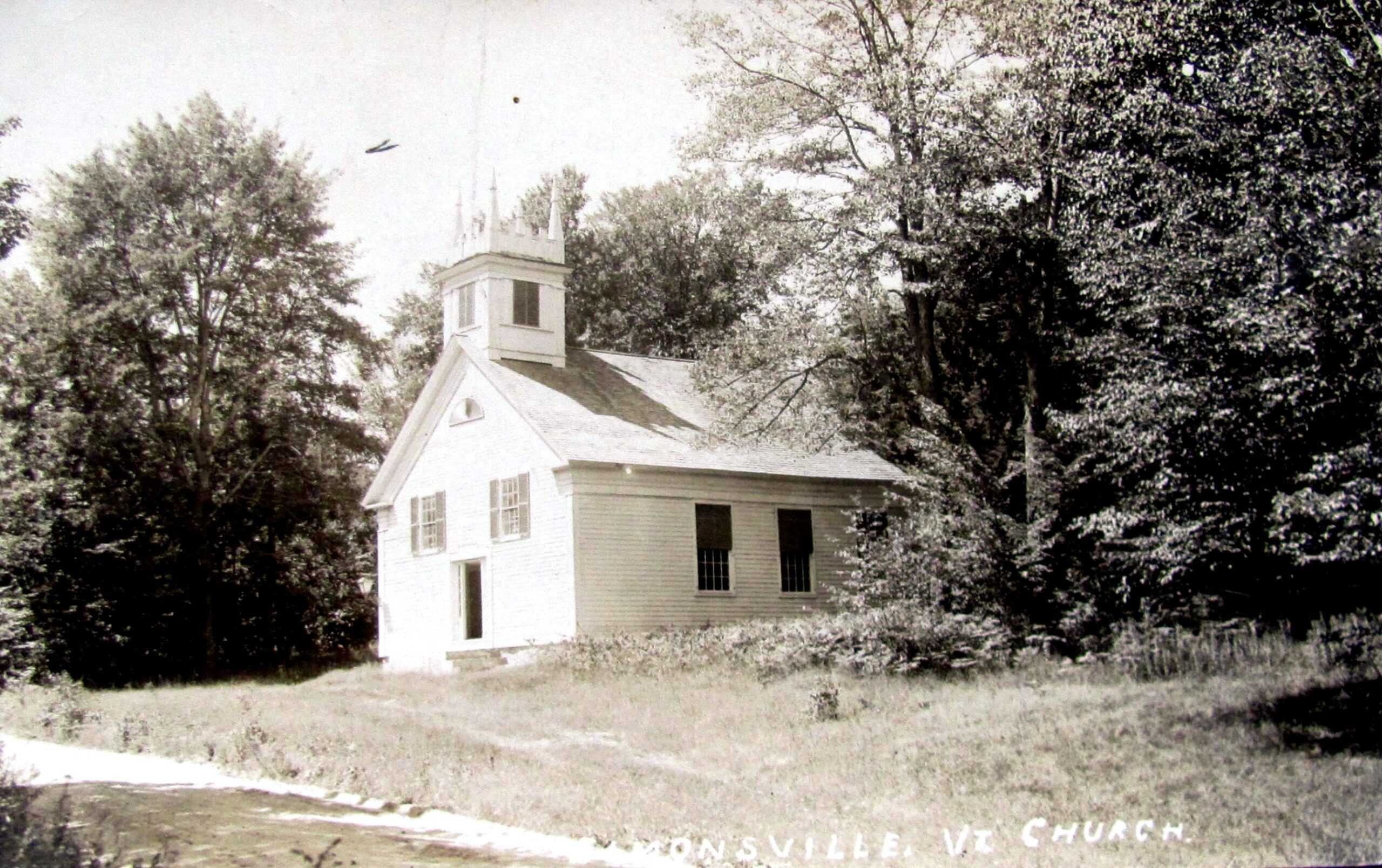
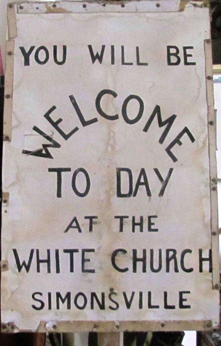
Simonsville
“SIMONSVILLE (pop. township 258) 23.6 m., is a tiny settlement with two bridges over the swift-running pebbly mountain stream that bends through the little village in white-rippled flow. Trim stone walls follow the curving line of the street and mark the water course.
“The little white Church with blunted tower is neatly built in a style similar to the Peru Church. Rowell’s Inn, was built in 1820 by Simons, who gave his name to the community. Constructed of red brick kilned on the farm, the building served as an inn and store, and retains such early features as the many fireplaces, Christian doors, and the third-floor ballroom. A double porch now fronts the first two floors, with a third smaller porch opening from the ell. In early automobile days, this inn was a stop-over on the ‘Ideal Tour’ between Manchester, Vermont and the White Mountains of New Hampshire.
“The Little Red Schoolhouse, 24.3 m., would serve to illustrate the well-loved song of that name, and brings memories of all the sentimental songs and poems dealing with rural schooldays.
“The Parsonage, 25 m., stands in the attractive sturdiness of red brick, made locally in Simonsville, and is early nineteenth century, having been used as a parsonage since its construction.”
“Between Simonsville and Chester, State 11 winds along an upland river valley, crossing and recrossing the rocky branch stream of the Williams River, with forested ridges paralleling the highway.
“Hard surface is resumed in its bituminous form. Eastward near Chester the country opens a bit, the valley widening to the clear land of better and more prosperous farms…”
This week’s old saying – Tourist: “Where does this road go?” Vermonter: “Nowhere, it stays right there.”