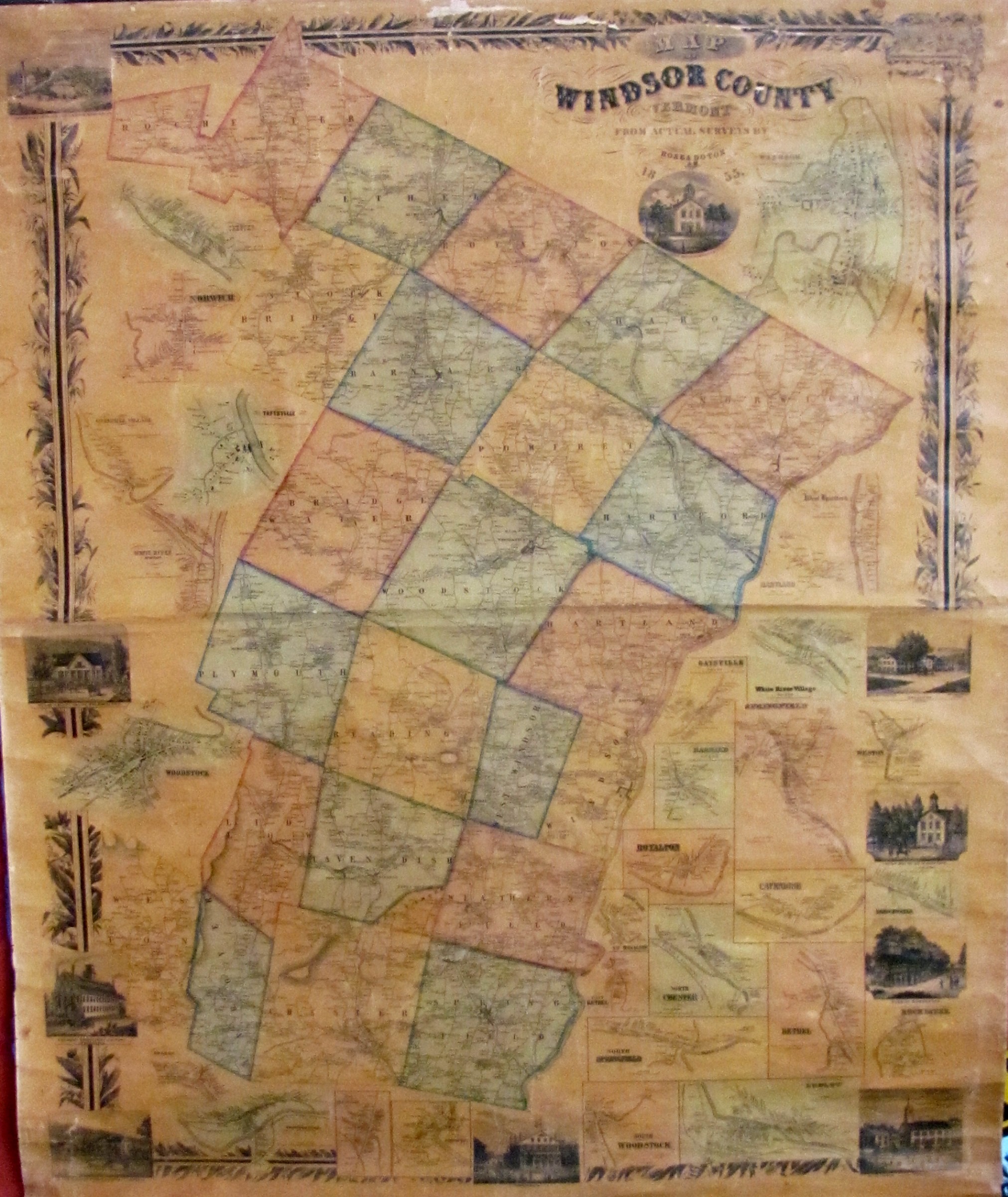
Last week, I wrote about Chester Historical Society’s loan of artifacts for the newly renovated upstairs of the Chester Town Hall. Continuing along that line, here is some history of the 1855 Doton map of Windsor County, now upstairs at town hall. We had this map shadow box framed and archivally preserved at the Framery of Vermont.
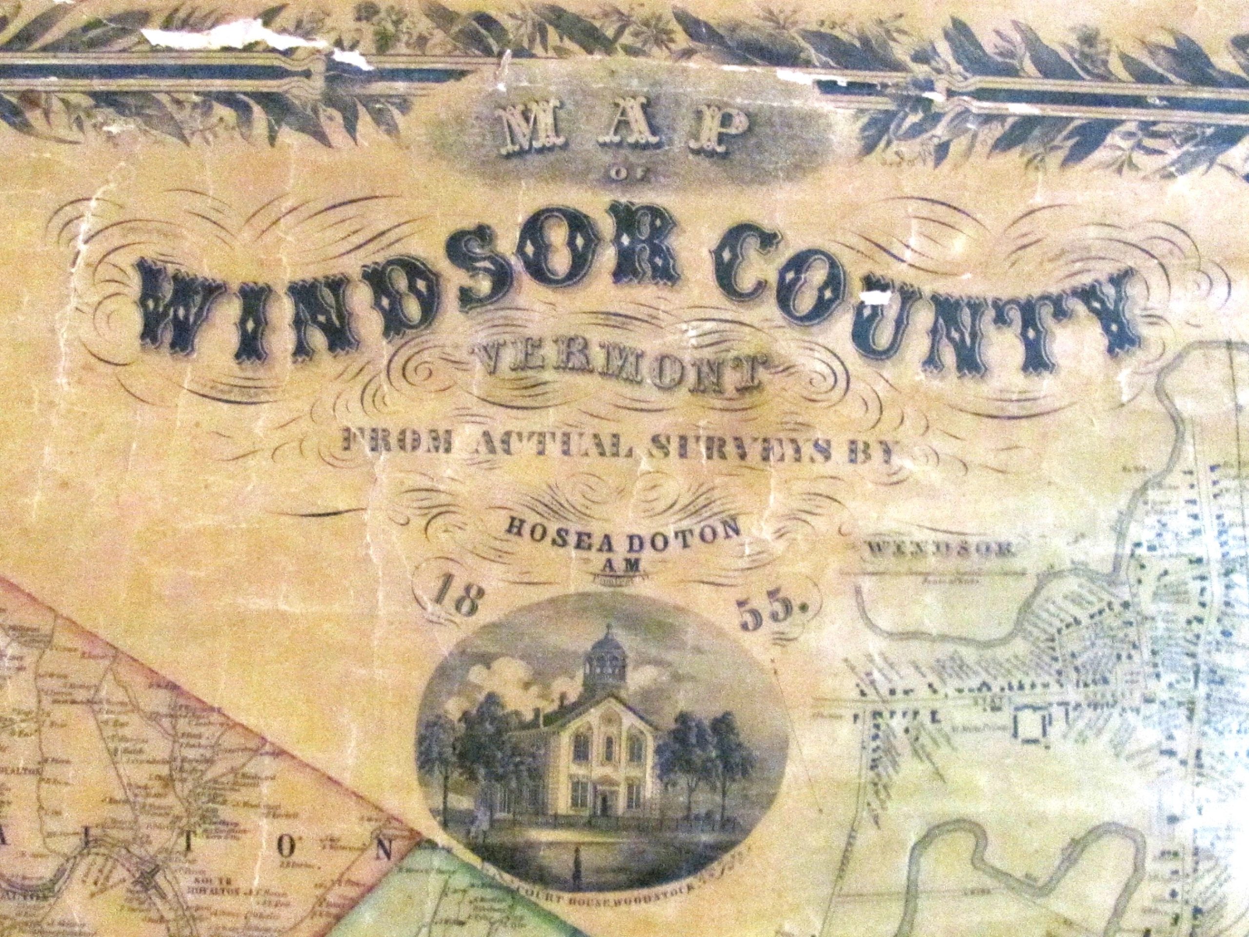
In 1855, Hosea Doton created a map of Windsor County. Doton was a native of Pomfret, Vt. Below is a bit of his history I found online.
“Hosea Doton (1809-1886), a Vermont educator and mathematician known in the history of cartography for his 1855 ‘Map of Windsor County Vermont from Actual Surveys.’
“After receiving a common school education, he studied by himself, and became one of the best mathematicians in the state. He taught at various places until 1850, when he opened a normal school in his native town, and continued it until 1866. Fully 150 of Mr. Doton’s pupils became successful teachers, and his school was a great aid to the educational system of the state. He also worked as a surveyor, and from 1866 until his death was chief engineer of the Woodstock railroad. His work in determining the altitudes of Vermont mountains is accepted as authority. He made astronomical calculations for the Vermont Register, and for 18 years kept a meteorological record, making full monthly reports to the war department at Washington. He was a member of the state Senate in 1865-1866, and in the latter year the legislature established his method of computing interest, known as the ‘Vermont rule.’ Mr. Doton received the degree of M.A. from Norwich University, Vt., in 1845. He published many scientific articles.”
Doton surveyed every town in Windsor County. This survey would include roads, streams, and villages. Roads were measured with a wheeled odometer, something like a wooden wheelbarrow wheel, drawn by a horse and buggy. So many revolutions equaled so may feet. As Doton passed your house, he would ask your name and record it on his map. As a result, these maps are a valuable resource for those who wish to document their house today.
Doton’s wall map measures about 56 inches high by 50 inches wide. These maps were made in four lithographed sections. Each section was pressed onto an inked soapstone plate with the map design engraved in the stone. The sections were then hand-colored to give the maps the colors we see today.
Each lithographed section was made of paper. When all four sections were complete, they were glued to a cloth backing for strength and then varnished. A wooden top strip, painted black, was added so the map could be hung on the wall. At the bottom of the map is a black painted wooden roller so the map could be rolled up. These maps cost $5 in 1855.
An interesting bit of Doton’s maps is as follows: Today we tend to think the earliest version of something like a map or book would be the most valuable. This is a good guideline, but not always true, as evidenced below.
After Doton published his 1855, map he noticed errors or omissions, so in 1856 he published a revised map. Now, you would think the 1855 map would be worth more; not true. Doton’s errors and omissions were so minor that few customers bought the 1856 version. For this reason, his 1856 maps are rarer and more valuable.
Over the years I have owned a number of these maps. In the 1980s, my best customers were lawyers in Windsor County. Today, historians and genealogists find these historical maps useful. If you have one, treasure it. If you don’t, find one. I have one for sale.
This week’s old saying: “Never trade one good item for 10 lesser items.”